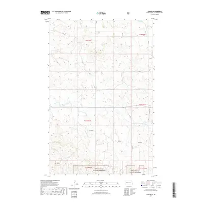
2017 Map of Schafer SE
USGS Topo · Published 2017About this map
Little Missouri National Grassland dominates the southern landscape of this McKenzie County region, where the prairie is etched by the drainage of Northfork Cr. The map captures a transition between the open plateau and the more complex drainage networks feeding the Missouri River system. Local history is anchored by the North Fork Trinity Cem, located near the intersection of Co Rte 45 and Beaver Crk Rd, serving as a vital point of interest for genealogists tracing family roots in this corner of North Dakota. In the northwest, Demicks Lake provides a natural landmark in a territory defined by section lines and rural thoroughfares like N Fork Rd and Stone Johny Rd. The inclusion of the Lmng site indicates the ongoing resource management and industrial footprints common in the western plains during this era.
Find a feature on this map
23 named features on this map. Tap any name to fly to it.
Don’t see what you’re looking for? This feature index may not catch every label — zoom into the map to look around manually.
Map Details
Editions of this 2017 Schafer SE Map
This is the sole edition of this map. No revisions or reprints were ever made.
Other maps of this area

1953 · Watford City
USGS Topo · 1:250,000

1957 · Watford City
USGS Topo · 1:250,000

1959 · Lone Butte NW
USGS Topo · 1:24,000

1959 · Croff
USGS Topo · 1:24,000

1959 · Lone Butte NE
USGS Topo · 1:24,000

1965 · Keene
USGS Topo · 1:24,000

1965 · Johnsons Corner
USGS Topo · 1:24,000

1967 · Watford City
USGS Topo · 1:250,000

1978 · Schafer
USGS Topo · 1:24,000
1978 · Schafer SE
USGS Topo · 1:24,000