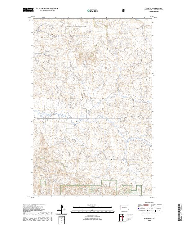
2024 Map of Schafer SE
USGS Topo · Published 2024About this map
Northfork Creek meanders through this portion of the North Dakota badlands, carving a complex network of coulees and drainage patterns across the landscape. The area is characterized by the presence of the Little Missouri National Grassland in the southern sections, reflecting the conservation and public land management efforts in McKenzie County. Cultural landmarks are sparse in this rural terrain, though the North Fork Trinity Cem stands as a significant site for local family history and genealogical research. The road network is primarily composed of section-line routes and local paths like Stone Johny Rd and N Fork Rd, illustrating the grid-based land survey system typical of the Great Plains. The topography shows the dramatic elevation shifts between the creek valleys and the surrounding high plateau, accessible via routes such as Beaver Crk Rd and Co Rd 45.
Find a feature on this map
23 named features on this map. Tap any name to fly to it.
Don’t see what you’re looking for? This feature index may not catch every label — zoom into the map to look around manually.
Map Details
Editions of this 2024 Schafer SE Map
This is the sole edition of this map. No revisions or reprints were ever made.
Other maps of this area

1953 · Watford City
USGS Topo · 1:250,000

1957 · Watford City
USGS Topo · 1:250,000

1959 · Lone Butte NW
USGS Topo · 1:24,000

1959 · Croff
USGS Topo · 1:24,000

1959 · Lone Butte NE
USGS Topo · 1:24,000

1965 · Keene
USGS Topo · 1:24,000

1965 · Johnsons Corner
USGS Topo · 1:24,000

1967 · Watford City
USGS Topo · 1:250,000

1978 · Schafer
USGS Topo · 1:24,000
1978 · Schafer SE
USGS Topo · 1:24,000