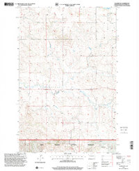
1997 Map of Schafer SE
USGS Topo · Published 2001About this map
Little Missouri National Grassland encompasses much of this territory in McKenzie County, defined by the erosion-carved breaks and draws of the North Fork. The landscape reflects a mix of preservation and local industry, where Scoria Pits are etched into the terrain near prominent high points like Blue Butte. A sense of the area's pioneer history is preserved at Trinity Cem, a lonely landmark in a region primarily dedicated to ranching and resource management. Natural water sources are scarce across these highlands, though Demicks Lake and various unnamed Springs provide critical collection points. The presence of a significant Pipeline cutting across the northwest corner illustrates the modern infrastructure layered over this traditional grazing land during the late twentieth century.
Find a feature on this map
11 named features on this map. Tap any name to fly to it.
Don’t see what you’re looking for? This feature index may not catch every label — zoom into the map to look around manually.
Map Details
Editions of this 1997 Schafer SE Map
This is the sole edition of this map. No revisions or reprints were ever made.
Other maps of this area

1953 · Watford City
USGS Topo · 1:250,000

1957 · Watford City
USGS Topo · 1:250,000

1959 · Lone Butte NW
USGS Topo · 1:24,000

1959 · Croff
USGS Topo · 1:24,000

1959 · Lone Butte NE
USGS Topo · 1:24,000

1965 · Keene
USGS Topo · 1:24,000

1965 · Johnsons Corner
USGS Topo · 1:24,000

1967 · Watford City
USGS Topo · 1:250,000

1978 · Schafer
USGS Topo · 1:24,000
1978 · Schafer SE
USGS Topo · 1:24,000