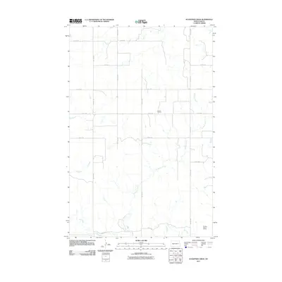
2011 Map of Schaffner Creek
USGS Topo · Published 2011About this map
Schaffner Creek meanders through the central plains of North Dakota, defining the hydrology of this rural landscape within Dunn County. The terrain is marked by the distinct drainage of Ash Coulee and the more prominent Knife River to the south. This environment is characterized by a sparse, organized grid of section roads including 80th Ave SW and 14th St SW, which facilitate movement between isolated agricultural tracts. The map documents significant local landmarks such as Broncho Cemetery, a vital site for genealogical research in this part of the state. Further south, the Crowley Resort Airstrip indicates a modern adaptation of the landscape, providing aerial access to this quiet interior region. The proximity of the river and creek systems highlights the importance of water management in the northern prairie.
Find a feature on this map
17 named features on this map. Tap any name to fly to it.
Don’t see what you’re looking for? This feature index may not catch every label — zoom into the map to look around manually.
Map Details
Editions of this 2011 Schaffner Creek Map
This is the sole edition of this map. No revisions or reprints were ever made.
Other maps of this area

1953 · Watford City
USGS Topo · 1:250,000

1957 · Watford City
USGS Topo · 1:250,000

1967 · Watford City
USGS Topo · 1:250,000

1973 · Marshall SE
USGS Topo · 1:24,000

1973 · Schaffner Creek NE
USGS Topo · 1:24,000

1973 · Willow Creek West
USGS Topo · 1:24,000

1973 · Schaffner Creek
USGS Topo · 1:24,000
1973 · Willow Creek East
USGS Topo · 1:24,000

1973 · Halliday
USGS Topo · 1:24,000

1973 · Dodge
USGS Topo · 1:24,000