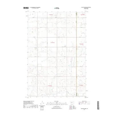
2017 Map of Schaffner Creek
USGS Topo · Published 2017About this map
Saint Martins Cem and Broncho Cem are the primary markers of local heritage in this rural stretch of western North Dakota. The landscape is defined by the drainage systems of Schaffner Cr and Ash Coulee, which cut through the high plains before feeding into the Knife River at the southern edge of the quadrangle. The map documents the precise section lines of the Public Land Survey System, spanning township boundaries from t144n r91w down to t142n r91w.
Find a feature on this map
21 named features on this map. Tap any name to fly to it.
Don’t see what you’re looking for? This feature index may not catch every label — zoom into the map to look around manually.
Map Details
Editions of this 2017 Schaffner Creek Map
This is the sole edition of this map. No revisions or reprints were ever made.
Other maps of this area

1953 · Watford City
USGS Topo · 1:250,000

1957 · Watford City
USGS Topo · 1:250,000

1967 · Watford City
USGS Topo · 1:250,000

1973 · Marshall SE
USGS Topo · 1:24,000

1973 · Schaffner Creek NE
USGS Topo · 1:24,000

1973 · Willow Creek West
USGS Topo · 1:24,000

1973 · Schaffner Creek
USGS Topo · 1:24,000
1973 · Willow Creek East
USGS Topo · 1:24,000

1973 · Halliday
USGS Topo · 1:24,000

1973 · Dodge
USGS Topo · 1:24,000