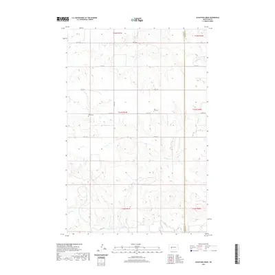
2020 Map of Schaffner Creek
USGS Topo · Published 2020About this map
The Knife River flows across the southwestern corner of this North Dakota landscape, carving a low-lying valley that contrasts with the surrounding upland prairie. This area, spanning the boundary of Dunn and Mercer Counties, is defined by a sparse but organized network of rural roads such as 81st Ave SW and 15th St SW. These gravel routes connect remote agricultural lands where small landmarks serve as the primary anchors for local history. Grounded in these section lines are two notable burial sites, Saint Martins Cem and Saint John Cem, which reflect the early settlement patterns of the region's homesteading families. Water remains a defining feature of the terrain, with Schaffner Cr and Ash Coulee drawing drainage patterns across the rolling plains toward the river valley below.
Find a feature on this map
21 named features on this map. Tap any name to fly to it.
Don’t see what you’re looking for? This feature index may not catch every label — zoom into the map to look around manually.
Map Details
Editions of this 2020 Schaffner Creek Map
This is the sole edition of this map. No revisions or reprints were ever made.
Other maps of this area

1953 · Watford City
USGS Topo · 1:250,000

1957 · Watford City
USGS Topo · 1:250,000

1967 · Watford City
USGS Topo · 1:250,000

1973 · Marshall SE
USGS Topo · 1:24,000

1973 · Schaffner Creek NE
USGS Topo · 1:24,000

1973 · Willow Creek West
USGS Topo · 1:24,000

1973 · Schaffner Creek
USGS Topo · 1:24,000
1973 · Willow Creek East
USGS Topo · 1:24,000

1973 · Halliday
USGS Topo · 1:24,000

1973 · Dodge
USGS Topo · 1:24,000