
1950 Map of Schell Mtn
USGS Topo · Published 1956About this map
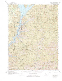
The Trinity River winds through the heart of the northern California mountains in the early 1950s, defining a landscape shaped by remote ranching and rugged mineral extraction. Small agricultural outposts like the Norwegian Ranch, Scott Ranch, and Trinity Farm appear as isolated clearings along the river flats and mountain benches. The terrain is notably marked by its mining history, with operations like the Catherine Mine, Star Mine, and Five Pines Mine scattered across the high ridges, while the Lamoine Mill Site indicates the industrial footprint in the northeast. Managed within the Shasta National Forest and Trinity National Forest, the map records numerous seasonal camps and cabins, such as Jim Wilson Flat and Garrity Cabin, linked by a network of trails and primitive roads like the Tollhouse path. This document captures the transition between historic hydraulic gold mining, evidenced by Tailings along the river, and the mid-century forest management era represented by the Trinity Mtn Guard Sta.
Find a feature on this map
145 named features on this map. Tap any name to fly to it.
Don’t see what you’re looking for? This feature index may not catch every label — zoom into the map to look around manually.
Map Details
Editions of this 1950 Schell Mtn Map
2 editions found
Other maps of this area

1886 · Shasta
USGS Topo · 1:250,000

1890 · Red Bluff
USGS Topo · 1:250,000

1894 · Red Bluff
USGS Topo · 1:250,000

1894 · Shasta
USGS Topo · 1:250,000

1901 · Redding
USGS Topo · 1:125,000

1913 · Weaverville
USGS Topo · 1:125,000

1923 · Sawyers Bar
USGS Topo · 1:125,000

1931 · Etna
USGS Topo · 1:96,000

1934 · Etna
USGS Topo · 1:125,000

1935 · Dunsmuir
USGS Topo · 1:125,000