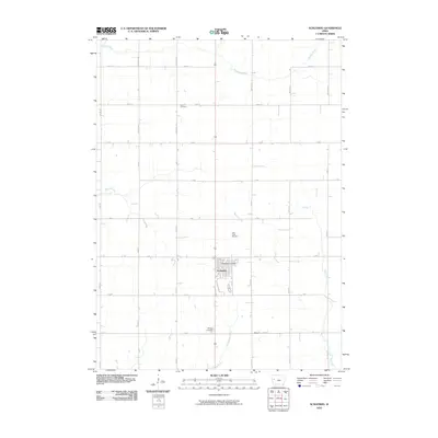
2010 Map of Schleswig
USGS Topo · Published 2010About this map
Schleswig serves as the central hub of this Crawford County landscape, where the town's residential grid is anchored by the Schleswig Post Office. The surrounding terrain is defined by a strictly organized township-and-range road system, with alphabetical and numerical routes like A Ave and 210th St carving the farmland into precise squares. Waterways break this geometric regularity, as the Soldier River and East Soldier River wind through the northern and southern portions of the map. Genealogists will find significant local history preserved in the scattered rural burial grounds, including Grant Cemetery to the north, Otter Creek Cemetery near the center, and Morgan Cemetery located further south near the small community of Morgan. The drainage patterns of Beaver Creek and Big Creek further illustrate the natural topography that dictated the placement of these early landmarks and homesteads.
Find a feature on this map
32 named features on this map. Tap any name to fly to it.
Don’t see what you’re looking for? This feature index may not catch every label — zoom into the map to look around manually.
Map Details
Editions of this 2010 Schleswig Map
This is the sole edition of this map. No revisions or reprints were ever made.
Other maps of this area

1954 · Fort Dodge
USGS Topo · 1:250,000

1957 · Fort Dodge
USGS Topo · 1:250,000

1958 · Fort Dodge
USGS Topo · 1:250,000

1967 · Ida Grove
USGS Topo · 1:24,000

1967 · Battle Creek
USGS Topo · 1:24,000

1971 · Ricketts
USGS Topo · 1:24,000

1971 · Schleswig
USGS Topo · 1:24,000

1971 · Denison
USGS Topo · 1:24,000
1971 · Charter Oak
USGS Topo · 1:24,000
1971 · Denison SW
USGS Topo · 1:24,000