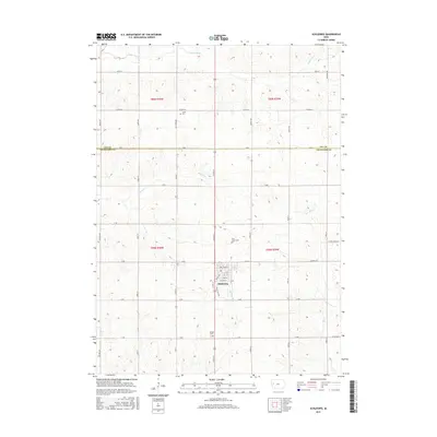
2015 Map of Schleswig
USGS Topo · Published 2015About this map
Schleswig serves as the primary hub in this corner of Crawford County, its street grid organized around thoroughfares such as Cedar St and Valley View Dr. The surrounding landscape is defined by its drainage systems, with the Soldier River cutting through the northern sections and the E Soldier River winding its way south from the town center. The topography is marked by the varied creek valleys of Beaver Cr and Big Cr, illustrating the typical Loess Hills-adjacent terrain of western Iowa.
Find a feature on this map
45 named features on this map. Tap any name to fly to it.
Don’t see what you’re looking for? This feature index may not catch every label — zoom into the map to look around manually.
Map Details
Editions of this 2015 Schleswig Map
This is the sole edition of this map. No revisions or reprints were ever made.
Other maps of this area

1954 · Fort Dodge
USGS Topo · 1:250,000

1957 · Fort Dodge
USGS Topo · 1:250,000

1958 · Fort Dodge
USGS Topo · 1:250,000

1967 · Ida Grove
USGS Topo · 1:24,000

1967 · Battle Creek
USGS Topo · 1:24,000

1971 · Ricketts
USGS Topo · 1:24,000

1971 · Schleswig
USGS Topo · 1:24,000

1971 · Denison
USGS Topo · 1:24,000
1971 · Charter Oak
USGS Topo · 1:24,000
1971 · Denison SW
USGS Topo · 1:24,000