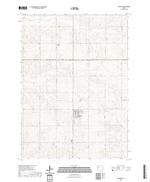
2022 Map of Schleswig
USGS Topo · Published 2022About this map
Schleswig occupies the southern reach of this agricultural landscape where the drainage of the Soldier River and its tributary, the E Soldier River, shapes the loess hills of western Iowa. The town's grid is detailed with local streets such as Hickory St, Glad St, and Valley View Dr, illustrating its established residential character. Moving north across the Ida Co and Crawford Co line, the map transitions into a dense network of section-line roads and named avenues including Keystone Ave and Market Ave. This 2022 survey captures several local landmarks essential for family history research, including Grant Cem in the north, Otter Creek Cem near the town center, and Morgan Cem to the south. Small watercourses like Beaver Cr and Big Cr weave through the sections, defining the natural boundaries of the rural farmsteads.
Find a feature on this map
42 named features on this map. Tap any name to fly to it.
Don’t see what you’re looking for? This feature index may not catch every label — zoom into the map to look around manually.
Map Details
Editions of this 2022 Schleswig Map
This is the sole edition of this map. No revisions or reprints were ever made.
Other maps of this area

1954 · Fort Dodge
USGS Topo · 1:250,000

1957 · Fort Dodge
USGS Topo · 1:250,000

1958 · Fort Dodge
USGS Topo · 1:250,000

1967 · Ida Grove
USGS Topo · 1:24,000

1967 · Battle Creek
USGS Topo · 1:24,000

1971 · Ricketts
USGS Topo · 1:24,000

1971 · Schleswig
USGS Topo · 1:24,000

1971 · Denison
USGS Topo · 1:24,000
1971 · Charter Oak
USGS Topo · 1:24,000
1971 · Denison SW
USGS Topo · 1:24,000