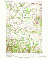
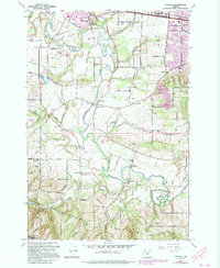
1961 Map of Scholls
USGS Topo · Published 1971About this map
The Tualatin River snakes through the center of this landscape, its tight oxbows defining the agricultural flats between Chahalem Mountains and Cooper Mountain. This early 1960s survey, with updates from the 1970s, captures the transition of Washington County from a purely rural river valley into an expanding suburban frontier. While smaller hamlets like Scholls, Farmington, and Laurel anchor the southern reaches, the northern portion shows the growth of Reedville and Hazeldale along the Southern Pacific railroad line. Local history is preserved in landmarks such as the Witch Hazel School, Grange Hall, and the Pleasant Hill Cemetery. The mapping of small farm roads like Burkhalter Road and Kinnaman Rd reflects a network of family-owned tracts and orchards that preceded the modern residential footprint.
Find a feature on this map
60 named features on this map. Tap any name to fly to it.
Don’t see what you’re looking for? This feature index may not catch every label — zoom into the map to look around manually.
Map Details
Editions of this 1961 Scholls Map
5 editions found
Other maps of this area

1915 · Hillsboro
USGS Topo · 1:62,500

1916 · Tualatin
USGS Topo · 1:62,500

1918 · Hillsboro
USGS Topo · 1:62,500

1939 · Tualatin
USGS Topo · 1:62,500

1940 · Tualatin
USGS Topo · 1:62,500

1940 · Hillsboro
USGS Topo · 1:62,500

1941 · Gales Creek
USGS Topo · 1:62,500

1941 · Yamhill
USGS Topo · 1:62,500

1942 · Yamhill
USGS Topo · 1:62,500

1948 · Vancouver
USGS Topo · 1:250,000