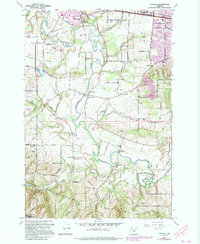
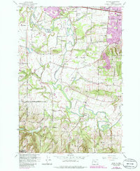
1961 Map of Scholls
USGS Topo · Published 1995About this map
The Tualatin River meanders through this portion of Washington County, defining the valley floor between the Chehalem Mountains to the south and Cooper Mountain to the east. By the early 1960s, the landscape was a patchwork of small agricultural settlements and rural schools, such as Groner Sch and Witch Hazel School. The settlement of Scholls serves as a central point where local roads converge near the river, while the Oregon Electric RR cuts through the northern sections near Reedville.
Find a feature on this map
57 named features on this map. Tap any name to fly to it.
Don’t see what you’re looking for? This feature index may not catch every label — zoom into the map to look around manually.
Map Details
Editions of this 1961 Scholls Map
5 editions found
Other maps of this area

1915 · Hillsboro
USGS Topo · 1:62,500

1916 · Tualatin
USGS Topo · 1:62,500

1918 · Hillsboro
USGS Topo · 1:62,500

1939 · Tualatin
USGS Topo · 1:62,500

1940 · Tualatin
USGS Topo · 1:62,500

1940 · Hillsboro
USGS Topo · 1:62,500

1941 · Gales Creek
USGS Topo · 1:62,500

1941 · Yamhill
USGS Topo · 1:62,500

1942 · Yamhill
USGS Topo · 1:62,500

1948 · Vancouver
USGS Topo · 1:250,000