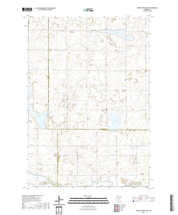
2022 Map of School Grove Lake
USGS Topo · Published 2022About this map
School Grove Lake and Timm Lake define the central landscape of this western Minnesota prairie region, situated at the intersection of Lyon, Redwood, and Yellow Medicine counties. The map captures a largely agricultural expanse where natural hydrology has been significantly modified over time, evidenced by the large footprints of Twin Lake Bed and Goose Lake Bed. These former lake basins, along with an extensive network of drainage infrastructure like Judicial Ditch Number Three and County Ditch Number Forty-six, reflect the historical effort to manage the high water table for productive farming.
Find a feature on this map
39 named features on this map. Tap any name to fly to it.
Don’t see what you’re looking for? This feature index may not catch every label — zoom into the map to look around manually.
Map Details
Editions of this 2022 School Grove Lake Map
This is the sole edition of this map. No revisions or reprints were ever made.
Other maps of this area

1953 · New Ulm
USGS Topo · 1:250,000

1957 · New Ulm
USGS Topo · 1:250,000

1958 · New Ulm
USGS Topo · 1:250,000

1962 · Wood Lake NW
USGS Topo · 1:24,000

1962 · Dudley
USGS Topo · 1:24,000

1962 · Cottonwood
USGS Topo · 1:24,000

1962 · School Grove Lake
USGS Topo · 1:24,000

1962 · Wood Lake
USGS Topo · 1:24,000

1962 · Milroy
USGS Topo · 1:24,000

1965 · Echo
USGS Topo · 1:24,000