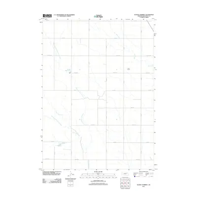
2011 Map of School Number 7
USGS Topo · Published 2011About this map
Berea Creek and the intricate tributaries of Point of Rocks Creek define the drainage patterns of this rural Box Butte County landscape. The area is organized by a precise grid of section-line roads, including Jefferson Rd, Lincoln Rd, and Madison Rd, reflecting the traditional township and range survey system. Water management is a central feature of the local geography, anchored by the Frost Reservoir and Luce Reservoir along with their respective impoundments, Frost Dam and Luce Dam. This network of creeks and small-scale reservoirs indicates a region dedicated to agricultural water security. Aviation history in this corner of Nebraska is represented by Cullan Airport, located centrally among the expansive fields and drainage branches like the North Branch Point of Rocks Creek.
Find a feature on this map
24 named features on this map. Tap any name to fly to it.
Don’t see what you’re looking for? This feature index may not catch every label — zoom into the map to look around manually.
Map Details
Editions of this 2011 School Number 7 Map
This is the sole edition of this map. No revisions or reprints were ever made.
Other maps of this area

1946 · Nonpareil
USGS Topo · 1:24,000

1947 · Bronco Lake
USGS Topo · 1:24,000

1948 · Hemingford
USGS Topo · 1:24,000

1948 · Hemingford 4 SW
USGS Topo · 1:24,000

1948 · Hemingford 4 SE
USGS Topo · 1:24,000

1948 · Berea Creek West
USGS Topo · 1:24,000

1948 · Hemingford 4 NE
USGS Topo · 1:24,000

1948 · Hemingford 4 NW
USGS Topo · 1:24,000

1948 · Nonpareil
USGS Topo · 1:24,000

1949 · Box Butte SW
USGS Topo · 1:24,000