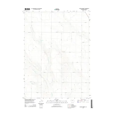
2014 Map of School Number 7
USGS Topo · Published 2014About this map
The High Plains of Box Butte County are defined here by a series of precise section-line roads and the branching drainage of Point of Rocks Cr. The rural character of the area is centered on School Number 7, situated along Keith Rd, serving a community organized by an extensive grid of county routes including Hayes Rd, Logan Rd, and Madison Rd. The landscape's intermittent water management is evident through the presence of Frost Reservoir and Luce Reservoir, which capture runoff in this semi-arid region. The map tracks the delicate hydrological network of the N Br Point of Rocks Cr and the S Br Point of Rocks Cr as they cut through the plateau. This 2014 survey documents the enduring agricultural structure of the Nebraska panhandle, where named roads and localized water features remain the primary landmarks for generations of residents.
Find a feature on this map
23 named features on this map. Tap any name to fly to it.
Don’t see what you’re looking for? This feature index may not catch every label — zoom into the map to look around manually.
Map Details
Editions of this 2014 School Number 7 Map
This is the sole edition of this map. No revisions or reprints were ever made.
Other maps of this area

1946 · Nonpareil
USGS Topo · 1:24,000

1947 · Bronco Lake
USGS Topo · 1:24,000

1948 · Hemingford
USGS Topo · 1:24,000

1948 · Hemingford 4 SW
USGS Topo · 1:24,000

1948 · Hemingford 4 SE
USGS Topo · 1:24,000

1948 · Berea Creek West
USGS Topo · 1:24,000

1948 · Hemingford 4 NE
USGS Topo · 1:24,000

1948 · Hemingford 4 NW
USGS Topo · 1:24,000

1948 · Nonpareil
USGS Topo · 1:24,000

1949 · Box Butte SW
USGS Topo · 1:24,000