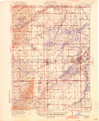
1922 Map of Schoolcraft
USGS Topo · Published 1944About this map
The village of Schoolcraft and the industrial hub of Vicksburg anchor this 1922 survey of southwestern Michigan, revealing a landscape defined by an intricate network of glacial lakes and intersecting railroads. The transit corridors are notably dense, featuring the Grand Trunk (Kalamazoo Br) RR and the Pennsylvania RR, alongside a stretch of the Michigan Central RR marked as abandoned by the early 1920s.
Find a feature on this map
100 named features on this map. Tap any name to fly to it.
Don’t see what you’re looking for? This feature index may not catch every label — zoom into the map to look around manually.
Map Details
Editions of this 1922 Schoolcraft Map
5 editions found
Other maps of this area

1914 · Three Rivers
USGS Topo · 1:62,500

1916 · Three Rivers
USGS Topo · 1:62,500

1916 · Kalamazoo
USGS Topo · 1:62,500

1918 · Kalamazoo
USGS Topo · 1:62,500

1918 · Galesburg
USGS Topo · 1:62,500

1918 · Leonidas
USGS Topo · 1:62,500

1922 · Schoolcraft
USGS Topo · 1:62,500

1943 · Three Rivers
USGS Topo · 1:62,500

1943 · Kalamazoo
USGS Topo · 1:62,500

1943 · Schoolcraft
USGS Topo · 1:62,500