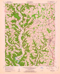
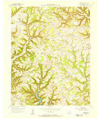
1961 Map of Science Hill
USGS Topo · Published 1962About this map
Fishing Creek and its complex network of tributaries, including Irvine Creek and Little Puncheon Creek, carve through the landscape of northern Pulaski County. This early 1960s survey illustrates a rural society organized around small settlements and rail transport, with the Southern railroad corridor anchoring communities like Science Hill and Pulaski. The map provides significant detail for genealogists, documenting numerous family burial grounds such as Vaught Cem, Eubanks Cem, and Wheeldon Cem. Social life is centered on local institutions like Briary Ch, Newell Ch, and the Hogue Sch. A distinct transition in the terrain is evident where the high ridges of Bethlehem Ridge and Mofield Ridge meet the flatlands of Higgins Flat, while the margin notes indicate areas subject to controlled inundation to the southwest, marking the influence of regional water management on the local topography.
Find a feature on this map
95 named features on this map. Tap any name to fly to it.
Don’t see what you’re looking for? This feature index may not catch every label — zoom into the map to look around manually.
Map Details
Editions of this 1961 Science Hill Map
2 editions found
Other maps of this area

1935 · Somerset
USGS Topo · 1:62,500

1952 · Eubank
USGS Topo · 1:24,000

1952 · Yosemite
USGS Topo · 1:24,000

1952 · Woodstock
USGS Topo · 1:24,000

1953 · Mintonville
USGS Topo · 1:24,000
1954 · Bobtown
USGS Topo · 1:24,000

1954 · Delmer
USGS Topo · 1:24,000

1954 · Science Hill
USGS Topo · 1:24,000
1954 · Somerset
USGS Topo · 1:24,000
1954 · Faubush
USGS Topo · 1:24,000