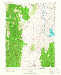
1952 Map of Scipio North
USGS Topo · Published 1968About this map
Scipio sits at the southern edge of this central Utah landscape, situated where the valley floor meets the rising peaks of the Fishlake National Forest. The geography is defined by the sharp contrast between the high summits of Wild Horse Peak and Fool Peak to the west and the riparian corridor of the Sevier River to the east. The river’s flow is captured by the Yuba Dam, forming the northern reaches of the Sevier Bridge Reservoir.
Find a feature on this map
58 named features on this map. Tap any name to fly to it.
Don’t see what you’re looking for? This feature index may not catch every label — zoom into the map to look around manually.
Map Details
Editions of this 1952 Scipio North Map
3 editions found
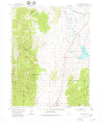
Other maps of this area

1885 · Manti
USGS Topo · 1:250,000

1885 · Sevier Desert
USGS Topo · 1:250,000

1895 · Manti
USGS Topo · 1:250,000

1951 · Oak City
USGS Topo · 1:62,500

1951 · Nephi
USGS Topo · 1:62,500

1952 · Scipio North
USGS Topo · 1:62,500

1953 · Delta
USGS Topo · 1:250,000

1956 · Price
USGS Topo · 1:250,000

1958 · Delta
USGS Topo · 1:250,000

1960 · Price
USGS Topo · 1:250,000