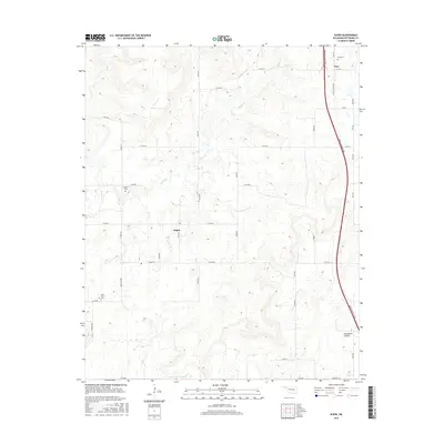
2016 Map of Scipio
USGS Topo · Published 2016About this map
Scipio and Ulan anchor this section of Pittsburg County, reflecting a landscape defined by small rural hubs and historical burial sites. The terrain is marked by the winding courses of Scipio Cr and Little Wildhorse Cr, with higher ground including the distinct Tannehill Prairie to the southeast. Genealogists and local historians will find significant value in the distribution of family and community landmarks, such as Ulan Cem, Hughlow Cem, and Lone Grove Cem. While the modern Indian Nation Tpke cuts a prominent north-south path through the eastern portion of the map, the surrounding section lines and local roads like Hugh Low Rd and Choate Prairie Rd preserve a more traditional rural layout. This survey captures the quiet continuity of these Oklahoma communities in the mid-2010s, where traditional land use meets modern transportation infrastructure.
Find a feature on this map
34 named features on this map. Tap any name to fly to it.
Don’t see what you’re looking for? This feature index may not catch every label — zoom into the map to look around manually.
Map Details
Editions of this 2016 Scipio Map
This is the sole edition of this map. No revisions or reprints were ever made.
Other maps of this area

1896 · Coalgate
USGS Topo · 1:125,000

1898 · McAlester
USGS Topo · 1:125,000

1899 · Coalgate
USGS Topo · 1:125,000

1900 · Canadian
USGS Topo · 1:125,000

1900 · Wewoka
USGS Topo · 1:125,000

1900 · Coalgate
USGS Topo · 1:125,000

1909 · Mc Alester
USGS Topo · 1:125,000

1946 · Fort Smith
USGS Topo · 1:250,000

1950 · Mcalester
USGS Topo · 1:250,000

1954 · Oklahoma City
USGS Topo · 1:250,000