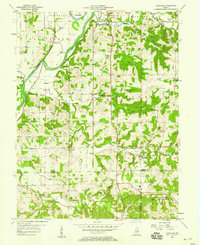
1957 Map of Scotland
USGS Topo · Published 1958About this map
The White River and its accompanying Bogard Bottoms define the western landscape of this mid-century Greene County study. The terrain shifts from the flat alluvial lands of Fairplay and Washington townships into the dissected uplands of Taylor and Cass. Of significant historical interest is the southeastern portion of the sheet, dominated by the US Naval Reservation Crane Ammunition Depot, which reshaped local land use and residency after its mid-century establishment.
Find a feature on this map
59 named features on this map. Tap any name to fly to it.
Don’t see what you’re looking for? This feature index may not catch every label — zoom into the map to look around manually.
Map Details
Editions of this 1957 Scotland Map
2 editions found
Other maps of this area

1908 · Bloomfield
USGS Topo · 1:62,500

1938 · Switz City
USGS Topo · 1:24,000

1943 · Lyons
USGS Topo · 1:24,000

1943 · Epsom
USGS Topo · 1:24,000

1947 · Switz City
USGS Topo · 1:24,000

1950 · Switz City
USGS Topo · 1:24,000

1950 · Odon
USGS Topo · 1:24,000

1951 · Bloomfield
USGS Topo · 1:24,000

1953 · Indianapolis
USGS Topo · 1:250,000

1956 · Indianapolis
USGS Topo · 1:250,000