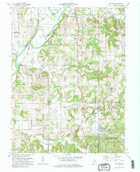
1979 Map of Scotland
USGS Topo · Published 1979About this map
White River oxbows and the low-lying Bogard Bottoms define the western portion of this landscape, where the Conrail line runs alongside scattered oil and gas wells. The terrain transitions from these alluvial flats into the dissected uplands of southern Greene County, where family names are preserved in landmarks like Jolliff Rocks and Sand Hill. Much of the southeastern corner is occupied by the U S Naval Reservation Weapons Support Center, a massive federal installation that contrasts with the traditional rural character of nearby Scotland.
Find a feature on this map
56 named features on this map. Tap any name to fly to it.
Don’t see what you’re looking for? This feature index may not catch every label — zoom into the map to look around manually.
Map Details
Editions of this 1979 Scotland Map
Other maps of this area

1908 · Bloomfield
USGS Topo · 1:62,500

1938 · Switz City
USGS Topo · 1:24,000

1943 · Lyons
USGS Topo · 1:24,000

1943 · Epsom
USGS Topo · 1:24,000

1947 · Switz City
USGS Topo · 1:24,000

1950 · Switz City
USGS Topo · 1:24,000

1950 · Odon
USGS Topo · 1:24,000

1951 · Bloomfield
USGS Topo · 1:24,000

1953 · Indianapolis
USGS Topo · 1:250,000

1956 · Indianapolis
USGS Topo · 1:250,000