
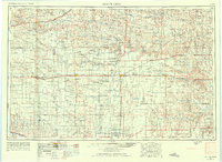
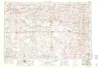
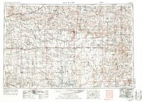
1955 Map of Scott City
USGS Topo · Published 1969About this map
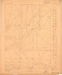
The Smoky Hill River and Arkansas River define the northern and southern reaches of this Western Kansas landscape, which reflects a mid-century agricultural and rail-dependent economy. The high plains terrain is dotted with numerous rural schools such as Skyline School, Beaver Creek School, and Lone Corner School, which served the dispersed farmsteads between larger hubs like Scott City and Sharon Springs. Transportation networks are dominated by the Union Pacific and the Atchison Topeka and Santa Fe railroads, which facilitated the movement of grain and livestock from regional points like Tribune and Oakley. A unique geological feature, the Chalk Pyramids, stands out amidst the prevailing topography of draws and creeks like White Woman Creek. Further south, the Sand hills mark the approach to the river valley, while landmarks like the Mark Hoard Mem and Dry Lake provide specific points of reference for local historians and genealogists tracing family land holdings.
Find a feature on this map
88 named features on this map. Tap any name to fly to it.
Don’t see what you’re looking for? This feature index may not catch every label — zoom into the map to look around manually.
Map Details
Editions of this 1955 Scott City Map
4 editions found
Other maps of this area

1890 · Granada
USGS Topo · 1:125,000

1891 · Albany
USGS Topo · 1:125,000

1891 · Larned
USGS Topo · 1:125,000

1892 · Ness
USGS Topo · 1:125,000

1892 · Dodge
USGS Topo · 1:125,000

1892 · Cheyenne Wells
USGS Topo · 1:125,000
1892 · Granada
USGS Topo · 1:125,000

1892 · Spearville
USGS Topo · 1:125,000

1893 · Ellis
USGS Topo · 1:125,000
1893 · Albany
USGS Topo · 1:125,000