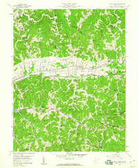
1958 Map of Scott Depot
USGS Topo · Published 1960About this map
Teays Valley dominates this 1958 topography, where the ancient westward-flowing riverbed of the pre-glacial Teays River has been repurposed by modern infrastructure. The Chesapeake and Ohio railroad and the Midland Trail run parallel through this geological corridor, connecting the settlements of Teays and Scott Depot. The map captures a transition toward suburban development, evidenced by the Golf Course at Sleepy Hollow and the Teays Valley Lakes, while maintaining deep roots in rural community life.
Find a feature on this map
52 named features on this map. Tap any name to fly to it.
Don’t see what you’re looking for? This feature index may not catch every label — zoom into the map to look around manually.
Map Details
Editions of this 1958 Scott Depot Map
4 editions found
Other maps of this area

1892 · Huntington
USGS Topo · 1:125,000

1898 · Huntington
USGS Topo · 1:125,000

1899 · Charleston
USGS Topo · 1:125,000

1902 · Milton
USGS Topo · 1:62,500

1906 · Glenwood
USGS Topo · 1:62,500

1906 · Winfield
USGS Topo · 1:62,500

1908 · Glenwood
USGS Topo · 1:62,500

1908 · Winfield
USGS Topo · 1:62,500

1909 · Saint Albans
USGS Topo · 1:62,500

1931 · Saint Albans
USGS Topo · 1:62,500