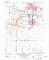
1963 Map of Scottsbluff South
USGS Topo · Published 1977About this map
The massive formations of Scotts Bluff National Monument dominate this western Nebraska landscape, where the North Platte River carves a path between the cities of Scottsbluff and Gering. This map documents a historic corridor of western expansion, tracing the paths of the Emigrant Trail and the Old Emigrant Trail as they move toward Mitchell Pass and Roubadeau Pass.
Find a feature on this map
57 named features on this map. Tap any name to fly to it.
Don’t see what you’re looking for? This feature index may not catch every label — zoom into the map to look around manually.
Map Details
Editions of this 1963 Scottsbluff South Map
2 editions found
Other maps of this area

1898 · Scotts Bluff
USGS Topo · 1:125,000

1954 · Scottsbluff
USGS Topo · 1:250,000

1958 · Scottsbluff
USGS Topo · 1:250,000

1963 · Scottsbluff South
USGS Topo · 1:24,000

1963 · Mitchell
USGS Topo · 1:24,000

1963 · Scottsbluff North
USGS Topo · 1:24,000

1963 · Roubadeau Pass
USGS Topo · 1:24,000

1965 · Minatare
USGS Topo · 1:24,000
1965 · Lake Alice
USGS Topo · 1:24,000

1973 · Scotts Bluff 4 NW
USGS Topo · 1:24,000