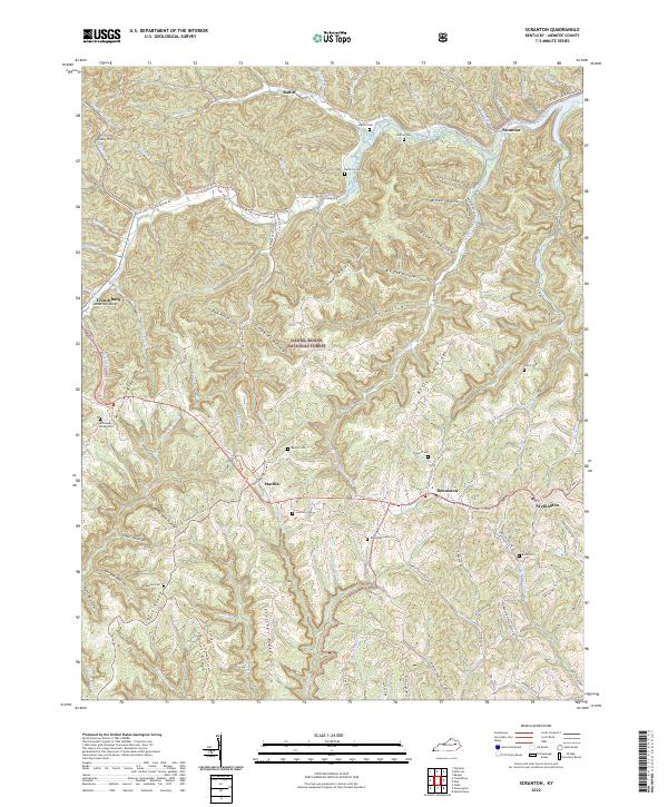
2022 Map of Scranton
USGS Topo · Published 2022About this map
Daniel Boone National Forest provides the backdrop for this look at Menifee County's deeply dissected landscape, where small communities like Mariba and Denniston occupy the limited level ground between winding hollows. The area's settlement history is etched into the terrain through numerous family burying grounds, such as Barker Cem, Lovelace Cem, and Station Cem, which are scattered across ridges and valley floors.
Find a feature on this map
76 named features on this map. Tap any name to fly to it.
Don’t see what you’re looking for? This feature index may not catch every label — zoom into the map to look around manually.
Map Details
Editions of this 2022 Scranton Map
This is the sole edition of this map. No revisions or reprints were ever made.
Other maps of this area

1889 · Salyersville
USGS Topo · 1:125,000

1891 · Salyersville
USGS Topo · 1:125,000

1892 · Beattyville
USGS Topo · 1:125,000

1899 · Salyersville
USGS Topo · 1:125,000

1929 · Morehead
USGS Topo · 1:48,000

1929 · Salt Lick
USGS Topo · 1:62,500

1934 · Salt Lick
USGS Topo · 1:62,500

1935 · Morehead
USGS Topo · 1:62,500

1951 · Ezel
USGS Topo · 1:24,000

1951 · Hazel Green
USGS Topo · 1:24,000