
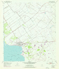
1952 Map of Seadrift
USGS Topo · Published 1953About this map
The coastal town of Seadrift sits at the edge of San Antonio Bay, defined in the early 1950s by its relationship with the water and the burgeoning petroleum industry. The landscape is a network of protective infrastructure, featuring an extensive levee system and a notable spoil bank running parallel to the shoreline. Economic activity is anchored by the Long Mott Oil Field, where numerous Oil Wells are connected by a grid of service roads and pipelines. This survey reveals the transition from a maritime and agricultural outpost to an industrial one, as the Missouri Pacific railroad cuts through the terrain to serve the town. Local life is anchored at the Roemerville Sch and the Seadrift Cem, while the bay floor is marked by Shell Reefs and the prominent protrusion of Swan Point.
Find a feature on this map
16 named features on this map. Tap any name to fly to it.
Don’t see what you’re looking for? This feature index may not catch every label — zoom into the map to look around manually.
Map Details
Editions of this 1952 Seadrift Map
2 editions found
Other maps of this area

1952 · Port Lavaca East
USGS Topo · 1:24,000

1952 · Mosquito Point
USGS Topo · 1:24,000

1952 · Long Island
USGS Topo · 1:24,000

1952 · Tivoli SE
USGS Topo · 1:24,000

1952 · Seadrift NE
USGS Topo · 1:24,000

1952 · Austwell
USGS Topo · 1:24,000

1952 · Port Lavaca West
USGS Topo · 1:24,000

1952 · Green Lake
USGS Topo · 1:24,000

1953 · Beeville
USGS Topo · 1:250,000

1956 · Beeville
USGS Topo · 1:250,000