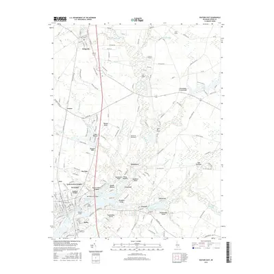
2016 Map of Seaford East
USGS Topo · Published 2016About this map
The Nanticoke River and its numerous tributaries, including Deep Creek and Gravelly Br, define the hydrology and settlement patterns of this section of the Delmarva Peninsula. The southern portion of the map is densely populated by the communities of Seaford, Blades, and several residential developments like Nanticoke Acres and Beaver Dam Heights. To the north, Bridgeville sits at the intersection of local routes and the Conrail Rd line.
Find a feature on this map
193 named features on this map. Tap any name to fly to it.
Don’t see what you’re looking for? This feature index may not catch every label — zoom into the map to look around manually.
Map Details
Editions of this 2016 Seaford East Map
This is the sole edition of this map. No revisions or reprints were ever made.
Other maps of this area

1915 · Seaford
USGS Topo · 1:62,500

1917 · Millsboro
USGS Topo · 1:62,500

1918 · Cedar Creek
USGS Topo · 1:62,500

1918 · Harrington
USGS Topo · 1:62,500

1919 · Cedar Creek
USGS Topo · 1:62,500

1938 · Cedar Creek
USGS Topo · 1:62,500

1938 · Millsboro
USGS Topo · 1:62,500

1944 · Cedar Creek
USGS Topo · 1:62,500

1944 · Millsboro
USGS Topo · 1:62,500

1944 · Seaford
USGS Topo · 1:62,500