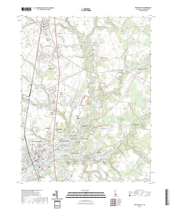
2023 Map of Seaford East
USGS Topo · Published 2023About this map
The Nanticoke River corridor serves as the primary artery for this region of Sussex County, anchoring the commercial and residential centers of Seaford and Blades. The landscape reveals a rich history of early industry and community life, marked by industrial landmarks like Hearns Mill, Lightfoots Furnace, and Old Furnace. These sites, along with a high density of religious and burial grounds such as Saint Lukes Cem and Macedonia Cem, point to a long-established settlement pattern where early water-powered mills and ironworks dictated the placement of towns.
Find a feature on this map
190 named features on this map. Tap any name to fly to it.
Don’t see what you’re looking for? This feature index may not catch every label — zoom into the map to look around manually.
Map Details
Editions of this 2023 Seaford East Map
This is the sole edition of this map. No revisions or reprints were ever made.
Other maps of this area

1915 · Seaford
USGS Topo · 1:62,500

1917 · Millsboro
USGS Topo · 1:62,500

1918 · Cedar Creek
USGS Topo · 1:62,500

1918 · Harrington
USGS Topo · 1:62,500

1919 · Cedar Creek
USGS Topo · 1:62,500

1938 · Cedar Creek
USGS Topo · 1:62,500

1938 · Millsboro
USGS Topo · 1:62,500

1944 · Cedar Creek
USGS Topo · 1:62,500

1944 · Millsboro
USGS Topo · 1:62,500

1944 · Seaford
USGS Topo · 1:62,500