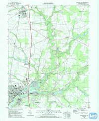
1992 Map of Seaford East
USGS Topo · Published 1992About this map
The Nanticoke River flows through the heart of Sussex County in the early 1990s, defining the industrial and residential growth of Seaford and the adjacent town of Blades. This period shows the transition of the riverfront from traditional maritime uses toward residential developments like Nanticoke Acres and Cherrytree Landing. The landscape is a complex network of wetlands and tidal branches, including Gravelly Branch and Deep Creek, which historically supported milling operations like the one at Hearns Mill. Local history is preserved in landmarks such as the Ross Mansion and the Sudler House, alongside several rural schools like the Fleagle Sch. The corridor of the Conrail railroad line remains a central axis for the settlements of Bridgeville and Cannon, illustrating the long-standing connection between rail transport and the agricultural economy of the Delmarva Peninsula.
Find a feature on this map
72 named features on this map. Tap any name to fly to it.
Don’t see what you’re looking for? This feature index may not catch every label — zoom into the map to look around manually.
Map Details
Editions of this 1992 Seaford East Map
This is the sole edition of this map. No revisions or reprints were ever made.
Other maps of this area

1915 · Seaford
USGS Topo · 1:62,500

1917 · Millsboro
USGS Topo · 1:62,500

1918 · Cedar Creek
USGS Topo · 1:62,500

1918 · Harrington
USGS Topo · 1:62,500

1919 · Cedar Creek
USGS Topo · 1:62,500

1938 · Cedar Creek
USGS Topo · 1:62,500

1938 · Millsboro
USGS Topo · 1:62,500

1944 · Cedar Creek
USGS Topo · 1:62,500

1944 · Millsboro
USGS Topo · 1:62,500

1944 · Seaford
USGS Topo · 1:62,500