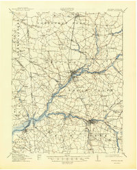
1915 Map of Seaford
USGS Topo · Published 1944About this map
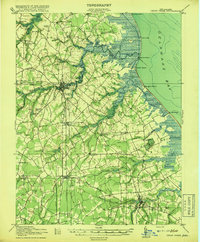
The Nanticoke River defines the landscape of Sussex County in this early 20th-century survey, serving as a primary corridor for commerce and travel. The map illustrates a vibrant riverine economy characterized by numerous maritime and milling sites, such as Hurts Wharf, Baileys Landing, and the Cannons Ferry crossing at Woodland. These points of transit connect the interior agricultural lands to the broader Chesapeake watershed.
Find a feature on this map
108 named features on this map. Tap any name to fly to it.
Don’t see what you’re looking for? This feature index may not catch every label — zoom into the map to look around manually.
Map Details
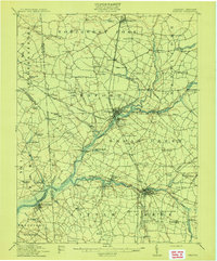
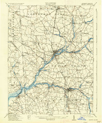
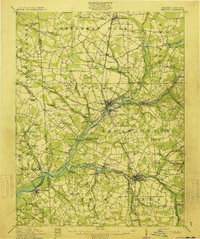
Editions of this 1915 Seaford Map
4 editions found
Other maps of this area

1901 · Salisbury
USGS Topo · 1:62,500

1902 · Pittsville
USGS Topo · 1:62,500

1903 · Nanticoke
USGS Topo · 1:62,500

1905 · Denton
USGS Topo · 1:62,500

1905 · Hurlock
USGS Topo · 1:62,500
1915 · Seaford
USGS Topo · 1:62,500

1917 · Millsboro
USGS Topo · 1:62,500
1918 · Cedar Creek
USGS Topo · 1:62,500
1918 · Harrington
USGS Topo · 1:62,500

1919 · Cedar Creek
USGS Topo · 1:62,500