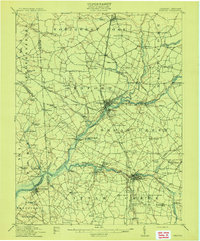
1915 Map of Seaford
USGS Topo · Published 1915About this map
Nanticoke River and Broad Creek serve as the primary arteries of Sussex County in this early twentieth-century study, where maritime and rail transport intersect. The town of Seaford sits at a critical junction where the Philadelphia and Washington rail line meets the water, supported by the Steamboat Route extending downriver. This era shows a landscape dense with small-scale rural infrastructure, from the numerous schools like Cokesbury School and Flowers School to local industry at Old Furnace Mill.
Find a feature on this map
94 named features on this map. Tap any name to fly to it.
Don’t see what you’re looking for? This feature index may not catch every label — zoom into the map to look around manually.
Map Details
Editions of this 1915 Seaford Map
4 editions found
Other maps of this area

1901 · Salisbury
USGS Topo · 1:62,500

1902 · Pittsville
USGS Topo · 1:62,500

1903 · Nanticoke
USGS Topo · 1:62,500

1905 · Denton
USGS Topo · 1:62,500

1905 · Hurlock
USGS Topo · 1:62,500

1915 · Seaford
USGS Topo · 1:62,500

1917 · Millsboro
USGS Topo · 1:62,500

1918 · Cedar Creek
USGS Topo · 1:62,500

1918 · Harrington
USGS Topo · 1:62,500

1919 · Cedar Creek
USGS Topo · 1:62,500