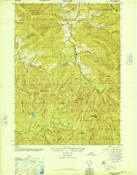
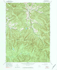
1945 Map of Seager
USGS Topo · Published 1945About this map
Catskill State Park encompasses the majority of this mid-1940s landscape, where high peaks like Graham Mtn and Doubletop Mtn tower over deeply carved hollows. The settlement at Seager sits along the Dry Brook, while further north, Mapledale is marked by the Lake Hill Cem and a nearby Mill. The interior terrain is defined by the Hardenburgh Range and numerous water bodies, including Furlough Lake and Balsam Lake.
Find a feature on this map
56 named features on this map. Tap any name to fly to it.
Don’t see what you’re looking for? This feature index may not catch every label — zoom into the map to look around manually.
Map Details
Editions of this 1945 Seager Map
5 editions found
Other maps of this area

1900 · Phoenicia
USGS Topo · 1:62,500

1901 · Margaretville
USGS Topo · 1:62,500

1903 · Phoenicia
USGS Topo · 1:62,500

1903 · Slide Mountain
USGS Topo · 1:62,500

1904 · Margaretville
USGS Topo · 1:62,500

1905 · Slide Mountain
USGS Topo · 1:62,500

1910 · Neversink
USGS Topo · 1:62,500

1942 · Neversink
USGS Topo · 1:62,500

1943 · Peekamoose Mountain
USGS Topo · 1:31,680

1943 · Monticello
USGS Topo · 1:125,000