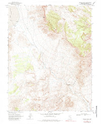
1970 Map of Seaman Wash
USGS Topo · Published 1984About this map
Coal Valley (Depression) defines the western reach of this Lincoln County landscape, captured during a 1970 field check of 1969 aerial photography. The terrain is dominated by the dramatic uplift of the Seaman Range, which cuts diagonally across the quadrangle. Water, though scarce in this arid environment, is marked by the presence of Seaman Spring and the drainage of Seaman Wash. This survey reflects the remote character of the Great Basin just before the 1980s, where human activity is limited to a few resource-driven features. A notable geological constriction occurs at the Seaman Narrows, where the wash passes through the high ground. Evidence of local excavation or road maintenance appears at a Borrow Pit, while travel through the area is restricted to a simple Jeep Trail.
Find a feature on this map
7 named features on this map. Tap any name to fly to it.
Don’t see what you’re looking for? This feature index may not catch every label — zoom into the map to look around manually.
Map Details
Editions of this 1970 Seaman Wash Map
2 editions found
Other maps of this area

1954 · Caliente
USGS Topo · 1:250,000

1959 · Caliente
USGS Topo · 1:250,000

1970 · Hiko NE
USGS Topo · 1:24,000

1970 · Oreana Spring
USGS Topo · 1:24,000

1970 · Seaman Wash
USGS Topo · 1:24,000

1970 · Fossil Peak
USGS Topo · 1:24,000
1970 · Weepah Spring
USGS Topo · 1:24,000
1970 · White River Narrows
USGS Topo · 1:24,000

1985 · Mail Summit
USGS Topo · 1:24,000

1985 · Coal Valley Reservoir
USGS Topo · 1:24,000