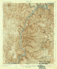
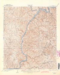
1934 Map of Searles
USGS Topo · Published 1934About this map
The Black Warrior River carves a deep path through this 1930s landscape, regulated by a series of massive engineering works including Lock No 16, Lock No 15, and Lock No 14. This survey, conducted just before the Great Depression, reveals a region defined by industrial extraction and rural communities. Settlements like Kellerman, Searles, and Brookwood are clustered in the southeast, tied together by the L and N RR and the M and O RR.
Find a feature on this map
38 named features on this map. Tap any name to fly to it.
Don’t see what you’re looking for? This feature index may not catch every label — zoom into the map to look around manually.
Map Details
Editions of this 1934 Searles Map
6 editions found

Other maps of this area

1893 · Jasper
USGS Topo · 1:125,000

1899 · Brookwood
USGS Topo · 1:125,000

1924 · Tuscaloosa
USGS Topo · 1:62,500

1926 · Samantha
USGS Topo · 1:48,000

1926 · Tuscaloosa
USGS Topo · 1:62,500

1927 · Adger
USGS Topo · 1:48,000

1928 · Samantha
USGS Topo · 1:62,500

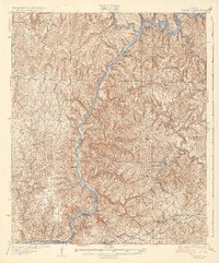
1929 · Searles
USGS Topo · 1:48,000

1931 · Cottondale
USGS Topo · 1:48,000

1932 · Yolande
USGS Topo · 1:62,500