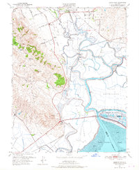
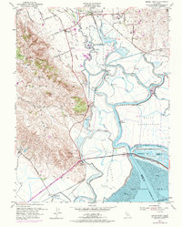
1951 Map of Sears Point
USGS Topo · Published 1967About this map
Sonoma Valley and the marshy transition into San Pablo Bay define this mid-century landscape where rail lines and tidal sloughs intersect. The Northwestern Pacific and Southern Pacific railroads crisscross the lowlands, serving small transit points like Schellville and Fairville. The area's agricultural and recreational character is evident in the presence of the Sonoma Valley Club and the Sweetwater Club, alongside a Rodeo Arena and a private landing field.
Find a feature on this map
58 named features on this map. Tap any name to fly to it.
Don’t see what you’re looking for? This feature index may not catch every label — zoom into the map to look around manually.
Map Details
Editions of this 1951 Sears Point Map
5 editions found
Other maps of this area

1902 · Napa
USGS Topo · 1:125,000

1914 · Petaluma
USGS Topo · 1:62,500

1916 · Mare Island
USGS Topo · 1:62,500

1916 · Santa Rosa
USGS Topo · 1:62,500

1942 · Mare Island
USGS Topo · 1:62,500

1942 · Sonoma
USGS Topo · 1:62,500

1942 · Petaluma
USGS Topo · 1:62,500

1944 · Santa Rosa
USGS Topo · 1:62,500

1947 · Santa Rosa
USGS Topo · 1:250,000

1949 · Santa Rosa
USGS Topo · 1:250,000