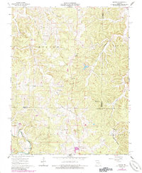
1963 Map of Seaton
USGS Topo · Published 1985About this map
The rolling landscape of the northern Ozarks is documented here at the intersection of Phelps, Crawford, and Dent Counties. Small crossroads settlements like Seaton and Winkler serve as focal points for a rural community defined by its watercourses, including Norman Creek and the West Fork Benton Creek. The map reveals a land utilized for both subsistence and industry, noting several unidentified Mine locations near Clinton and along the southern borders.
Find a feature on this map
32 named features on this map. Tap any name to fly to it.
Don’t see what you’re looking for? This feature index may not catch every label — zoom into the map to look around manually.
Map Details
Editions of this 1963 Seaton Map
3 editions found
Other maps of this area

1928 · Meramec Spring
USGS Topo · 1:62,500

1932 · Steelville
USGS Topo · 1:48,000

1933 · Steelville
USGS Topo · 1:62,500

1937 · Steelville
USGS Topo · 1:62,500

1941 · Salem
USGS Topo · 1:62,500

1941 · Stone Hill
USGS Topo · 1:62,500

1945 · Salem
USGS Topo · 1:62,500

1945 · Stone Hill
USGS Topo · 1:62,500

1949 · Rolla
USGS Topo · 1:250,000

1949 · Meramec Spring
USGS Topo · 1:62,500