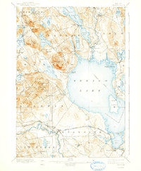
1896 Map of Sebago
USGS Topo · Published 1942About this map
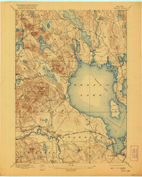
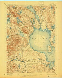
Sebago Lake dominates this late-nineteenth-century landscape, serving as a vital nexus for both recreation and transport in Cumberland County. A designated Steamboat Route traces a path through the open water, connecting the large lake to Long Lake via the Songo River. The infrastructure of the era is remarkably preserved, showing the precise operation of the Songo Lock and the path of the Maine Central R. R. (White Mountains Line) as it skirts the southern reaches through Richville and Steep Falls. Settled communities like Naples, South Casco, and East Sebago appear as clusters of activity along the shorelines, while the interior is defined by named peaks such as Peaked Hills and Douglas Hill. This survey highlights a transitional period where river-based industry at sites like Perley Mills coexisted with the growing role of the lakes as regional travel corridors.
Find a feature on this map
79 named features on this map. Tap any name to fly to it.
Don’t see what you’re looking for? This feature index may not catch every label — zoom into the map to look around manually.
Map Details
Editions of this 1896 Sebago Map
8 editions found
Other maps of this area

1891 · Portland
USGS Topo · 1:62,500

1891 · Buxton
USGS Topo · 1:62,500

1891 · Newfield
USGS Topo · 1:62,500

1892 · Buxton
USGS Topo · 1:62,500

1893 · Portland
USGS Topo · 1:62,500

1893 · Buxton
USGS Topo · 1:62,500

1893 · Newfield
USGS Topo · 1:62,500

1894 · Gray
USGS Topo · 1:62,500

1896 · Norway
USGS Topo · 1:62,500

1896 · Sebago
USGS Topo · 1:62,500