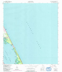
1949 Map of Sebastian NW
USGS Topo · Published 1993About this map
Floridana Beach and the coastal barrier strip near Micco define this 1949 survey, which was updated with aerial photography in 1970. The narrow peninsula is separated from the mainland by the Indian River, where the Intracoastal Waterway provides a crucial navigation route for coastal traffic. Numerous small inlets and marshy points characterize the western shore of the barrier island, including Ballard Cove, Pepper Cove, and Mathers Cove.
Find a feature on this map
20 named features on this map. Tap any name to fly to it.
Don’t see what you’re looking for? This feature index may not catch every label — zoom into the map to look around manually.
Map Details
Editions of this 1949 Sebastian NW Map
5 editions found
Other maps of this area

1949 · Fellsmere
USGS Topo · 1:24,000

1949 · Melbourne East
USGS Topo · 1:24,000

1949 · Sebastian NW
USGS Topo · 1:24,000

1949 · Sebastian
USGS Topo · 1:24,000

1949 · Grant
USGS Topo · 1:24,000

1951 · Sebastian NW
USGS Topo · 1:24,000

1951 · Melbourne East
USGS Topo · 1:24,000

1951 · Fellsmere
USGS Topo · 1:24,000

1951 · Grant
USGS Topo · 1:24,000

1951 · Sebastian
USGS Topo · 1:24,000