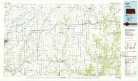
1985 Map of Sedan
USGS Topo · Published 1985About this map
The Atchison Topeka and Santa Fe railroad corridor serves as the primary industrial artery through this mid-1980s landscape, connecting towns like Moline and Elk Falls across Chautauqua and Cowley Counties. The geography is defined by a dense network of tributaries including Grouse Creek, Cedar Creek, and the Walnut River, while an ancient Indian Treaty Boundary line cuts across the southern terrain. This planimetric study reveals a rural economy dependent on both transportation and resource extraction, evidenced by numerous Quarry sites and a local Landing Strip near Cedar Vale. Conservation and public facilities are prominent at the Cowley State Fishing Lake and the State Hospital near Winfield, providing a clear look at the region’s institutional and recreational infrastructure during this era.
Find a feature on this map
91 named features on this map. Tap any name to fly to it.
Don’t see what you’re looking for? This feature index may not catch every label — zoom into the map to look around manually.
Map Details
Editions of this 1985 Sedan Map
2 editions found
Other maps of this area

1885 · Eureka
USGS Topo · 1:125,000

1885 · Sedan
USGS Topo · 1:125,000

1886 · Fredonia
USGS Topo · 1:125,000

1886 · Independence
USGS Topo · 1:125,000

1888 · Eureka
USGS Topo · 1:125,000

1888 · Eldorado
USGS Topo · 1:125,000

1889 · Burden
USGS Topo · 1:125,000

1889 · Sedan
USGS Topo · 1:125,000

1889 · Wichita
USGS Topo · 1:125,000

1890 · Wellington
USGS Topo · 1:125,000