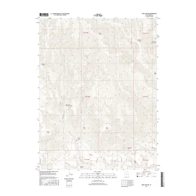
2017 Map of Sego Canyon
USGS Topo · Published 2017About this map
Sego sits at the heart of this Grand County terrain, positioned along Sego Cyn Rd as it winds through the deep drainage of the Book Cliffs. The landscape is defined by its complex network of washes and canyons, most notably Thompson Canyon and Sagers Canyon, which carve through the high plateaus of Sagers Bench and Pinto Bench. The presence of the Sego Canyon Sego Cem provides a specific point of interest for genealogists and local historians tracking the inhabitants of this canyon community. The map illustrates how human settlement and infrastructure, such as Sego Canyon Rd, have been constrained by the natural geometry of the cliffs. From the western edge near Renegade Canyon to the eastern reaches of Nash Wash, the document reveals a territory where narrow corridors like Salt Wash and Bootlegger Wash dictated movement and land use.
Find a feature on this map
25 named features on this map. Tap any name to fly to it.
Don’t see what you’re looking for? This feature index may not catch every label — zoom into the map to look around manually.
Map Details
Editions of this 2017 Sego Canyon Map
This is the sole edition of this map. No revisions or reprints were ever made.
Other maps of this area

1885 · East Tavaputs
USGS Topo · 1:250,000

1885 · La Sal
USGS Topo · 1:250,000

1956 · Moab
USGS Topo · 1:250,000

1956 · Grand Junction
USGS Topo · 1:250,000

1958 · Crescent Junction
USGS Topo · 1:62,500

1958 · Thompson
USGS Topo · 1:62,500

1959 · Grand Junction
USGS Topo · 1:250,000

1959 · Moab
USGS Topo · 1:250,000

1960 · Moab
USGS Topo · 1:250,000

1960 · Grand Junction
USGS Topo · 1:250,000