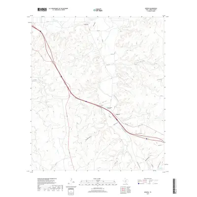
2019 Map of Segovia
USGS Topo · Published 2019About this map
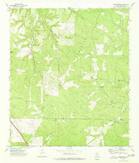
Segovia anchors this portion of the Texas Hill Country, situated where the Johnson Fork meets the complex drainage systems of Sycamore Cr and Pole Hollow. The landscape is defined by its deep incisions, including Stroope Canyon and Eli Hollow, which navigate towards the Llano River in the north. This modern survey illustrates how infrastructure like the State Highway 27 Bridge and Segovia Access Rd S interact with the traditional terrain, which is dotted with sites of genealogical interest such as Schrier Cem. Local ranching history is suggested by the presence of Headquarters Springs and a network of named tracks like Old Segovia Wulff Rd and Wiseman Rd. Notable natural features like The Bogs and the prominent Cloud Point overlook the river valley, marking a terrain where water sources and high ground have long dictated human movement.
Find a feature on this map
35 named features on this map. Tap any name to fly to it.
Don’t see what you’re looking for? This feature index may not catch every label — zoom into the map to look around manually.
Map Details
Editions of this 2019 Segovia Map
This is the sole edition of this map. No revisions or reprints were ever made.
Other maps of this area

1932 · Junction
USGS Topo · 1:62,500

1954 · Llano
USGS Topo · 1:250,000

1955 · Llano
USGS Topo · 1:250,000

1956 · Llano
USGS Topo · 1:250,000

1968 · Yates
USGS Topo · 1:24,000

1970 · Elm Slough
USGS Topo · 1:24,000
1970 · Big Draw
USGS Topo · 1:24,000
1974 · Junction
USGS Topo · 1:24,000
1974 · Junction SE
USGS Topo · 1:24,000
1974 · Tobe Branch
USGS Topo · 1:24,000