
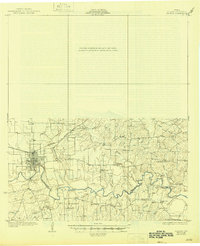
1930 Map of Seguin
USGS Topo · Published 1930About this map
The Guadalupe River snakes through this landscape of the mid-1920s, anchoring a community defined by rural schools and specialized riverside industries. The city of Seguin serves as the regional hub, situated where the Southern Pacific railroad meets the river's northern banks. Beyond the town center, the map reveals a dense network of family and community landmarks, including agricultural and commercial points like Faust Gin, Wolf Store, and Zabriskie Store.
Find a feature on this map
35 named features on this map. Tap any name to fly to it.
Don’t see what you’re looking for? This feature index may not catch every label — zoom into the map to look around manually.
Map Details
Editions of this 1930 Seguin Map
2 editions found
Other maps of this area

1911 · San Marcos
USGS Topo · 1:125,000

1919 · San Marcos
USGS Topo · 1:125,000

1920 · Smiley
USGS Topo · 1:125,000

1924 · New Braunfels No 4
USGS Topo · 1:48,000

1924 · San Marcos 3-c
USGS Topo · 1:48,000

1924 · San Marcos 3-d
USGS Topo · 1:48,000

1925 · San Marcos 4-c
USGS Topo · 1:48,000

1925 · New Braunfels No 1
USGS Topo · 1:48,000

1927 · New Braunfels
USGS Topo · 1:62,500

1929 · Hunter
USGS Topo · 1:62,500