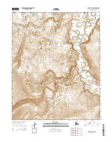
2015 Map of Selawik A-1 SE
USGS Topo · Published 2015About this map
Tagagawik River meanders through this portion of the Northwest Arctic Borough, following a complex path across a landscape defined by significant elevation changes. The waterway dominates the eastern half of the region, characterized by its winding oxbows and shifting channels that indicate a dynamic hydraulic environment. This 2015 survey illustrates the remote wilderness of Alaska, where the terrain rises from the river valley toward the western uplands. The mapping of township and range boundaries, including t8n r3w, t8n r2w, t7n r3w, and t7n r2w, provides the essential legal framework for this otherwise undeveloped expanse, offering a precise view of the land before any modern infrastructure or settlement took hold in this specific quadrangle.
Find a feature on this map
5 named features on this map. Tap any name to fly to it.
Don’t see what you’re looking for? This feature index may not catch every label — zoom into the map to look around manually.
Map Details
Editions of this 2015 Selawik A-1 SE Map
This is the sole edition of this map. No revisions or reprints were ever made.
Other maps of this area

1951 · Candle
USGS Topo · 1:250,000

1951 · Selawik
USGS Topo · 1:250,000

1951 · Shungnak
USGS Topo · 1:250,000

1951 · Kateel River
USGS Topo · 1:250,000
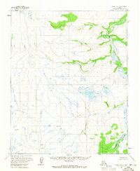
1954 · Candle D-1
USGS Topo · 1:63,360

1954 · Kateel River D-6
USGS Topo · 1:63,360

1955 · Shungnak
USGS Topo · 1:250,000

1955 · Kateel River
USGS Topo · 1:250,000

1955 · Candle
USGS Topo · 1:250,000

1957 · Selawik
USGS Topo · 1:250,000