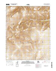
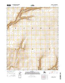
2014 Map of Selawik A-2 SE
USGS Topo · Published 2014About this map
The N Fork Buckland River meanders across this northern landscape, forming a primary hydrological artery through the township boundaries of t8n r4w and t7n r4w. This 2014 survey documents the complex topography of the Northwest Arctic, where the drainage systems define the movement and potential encampments of the region. In the western reaches, the headwaters of the Fish River emerge from the high-elevation contours, marking a distinct watershed divide. The absence of roads or permanent structures on this sheet underscores the preservation of a traditional Alaskan wilderness character, where topographical features and watercourses provide the only reliable navigational landmarks for travel and subsistence land use.
Find a feature on this map
6 named features on this map. Tap any name to fly to it.
Don’t see what you’re looking for? This feature index may not catch every label — zoom into the map to look around manually.
Map Details
Editions of this 2014 Selawik A-2 SE Map
This is the sole edition of this map. No revisions or reprints were ever made.
Other maps of this area

1951 · Candle
USGS Topo · 1:250,000

1951 · Selawik
USGS Topo · 1:250,000
1954 · Candle D-1
USGS Topo · 1:63,360

1954 · Candle D-2
USGS Topo · 1:63,360

1955 · Candle
USGS Topo · 1:250,000

1957 · Selawik
USGS Topo · 1:250,000

1964 · Candle
USGS Topo · 1:250,000
1985 · Selawik A-1
USGS Topo · 1:63,360
1985 · Selawik A-2
USGS Topo · 1:63,360
2014 · Candle D-2 NW
USGS Topo · 1:25,000