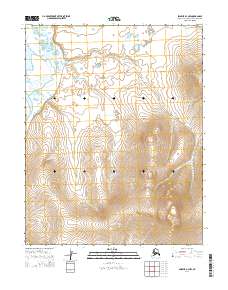
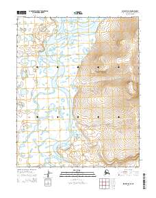
2014 Map of Selawik A-4 NW
USGS Topo · Published 2014About this map
Buckland River winds through the northwestern corner of this Arctic terrain, marking the primary topographical focus in an otherwise austere landscape. This 2014 survey documents a vast section of the Northwest Arctic Borough, defined by significant elevation changes that rise sharply from the river valley toward the southeastern interior. The absence of roads or named settlements reflects the wilderness character of this region, where the Buckland River serves as the dominant geographic landmark for navigation. This map is essential for understanding the natural drainage and land contours within the T10N and T9N township blocks, providing a clear record of the area's physical state in the early 21st century.
Find a feature on this map
7 named features on this map. Tap any name to fly to it.
Don’t see what you’re looking for? This feature index may not catch every label — zoom into the map to look around manually.
Map Details
Editions of this 2014 Selawik A-4 NW Map
This is the sole edition of this map. No revisions or reprints were ever made.
Other maps of this area

1951 · Selawik
USGS Topo · 1:250,000

1951 · Selawik A-5
USGS Topo · 1:63,360

1951 · Selawik B-5
USGS Topo · 1:63,360

1955 · Selawik A-4
USGS Topo · 1:63,360

1955 · Selawik B-4
USGS Topo · 1:63,360

1957 · Selawik
USGS Topo · 1:250,000
2014 · Selawik A-4 SW
USGS Topo · 1:25,000
2014 · Selawik A-4 SE
USGS Topo · 1:25,000
2014 · Selawik A-5 NE
USGS Topo · 1:25,000
2014 · Selawik A-5 SE
USGS Topo · 1:25,000