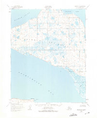
1951 Map of Selawik B-5
USGS Topo · Published 1975About this map
Baldwin Peninsula dominates this coastal survey, serving as a prominent landmass separating the waters of Hotham Inlet and Selawik Lake to the north from the expansive Eschscholtz Bay to the south. The mapping reflects a landscape of critical importance for Arctic logistics and transport during the early 1950s. On the southern shoreline, Elephant Point and the nearby Baldwin Seaplane Base indicate a hub of aviation and maritime activity. The interior of the peninsula is characterized by hundreds of small unnamed water bodies, while the Kauk River meanders into the bay along the southeastern coastline. Isolated structures like the lone Cabin on the northern shore suggest the sparse, seasonal human presence typical of the era in the Northwest Arctic.
Find a feature on this map
9 named features on this map. Tap any name to fly to it.
Don’t see what you’re looking for? This feature index may not catch every label — zoom into the map to look around manually.
Map Details
Editions of this 1951 Selawik B-5 Map
2 editions found
Other maps of this area

1951 · Selawik
USGS Topo · 1:250,000

1951 · Selawik C-6
USGS Topo · 1:63,360

1951 · Selawik B-6
USGS Topo · 1:63,360

1951 · Selawik A-5
USGS Topo · 1:63,360

1951 · Selawik B-5
USGS Topo · 1:63,360

1951 · Selawik A-6
USGS Topo · 1:63,360

1955 · Selawik A-4
USGS Topo · 1:63,360

1955 · Selawik B-4
USGS Topo · 1:63,360

1955 · Selawik C-5
USGS Topo · 1:63,360

1955 · Selawik C-4
USGS Topo · 1:63,360