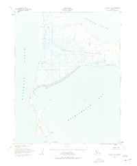
1951 Map of Selawik B-6
USGS Topo · Published 1975About this map
Baldwin Peninsula dominates this coastal landscape, separating the waters of Kotzebue Sound from Hotham Inlet. Surveyed in the early 1950s, the map reveals a remote environment where human presence is marked by utility and survival, such as the Arctic Landing Strip on the western coast and the isolated Callahan Shelter Cabin to the east.
Find a feature on this map
18 named features on this map. Tap any name to fly to it.
Don’t see what you’re looking for? This feature index may not catch every label — zoom into the map to look around manually.
Map Details
Editions of this 1951 Selawik B-6 Map
3 editions found
Other maps of this area

1950 · Kotzebue A-1
USGS Topo · 1:63,360

1951 · Selawik
USGS Topo · 1:250,000

1951 · Kotzebue
USGS Topo · 1:250,000

1951 · Selawik C-6
USGS Topo · 1:63,360

1951 · Selawik B-6
USGS Topo · 1:63,360

1951 · Selawik A-5
USGS Topo · 1:63,360

1951 · Selawik B-5
USGS Topo · 1:63,360
1951 · Kotzebue C-1
USGS Topo · 1:63,360

1951 · Selawik A-6
USGS Topo · 1:63,360

1955 · Selawik C-5
USGS Topo · 1:63,360