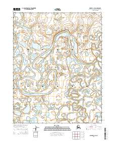
2015 Map of Selawik C-1 SE
USGS Topo · Published 2015About this map
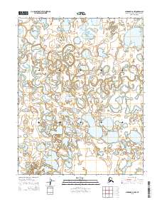
The Selawik River meanders extensively through this low-lying Arctic landscape, creating a complex network of oxbow lakes, sloughs, and marshy wetlands typical of the region's inland drainage basins. This 2015 U.S. Geological Survey representation of the Northwest Arctic highlights the intersection of the main river channel with the Kugarak River, which enters from the northeast. The terrain is characterized by a nearly flat elevation profile, where the waterways constantly shift their paths over time, leaving behind a scarred landscape of former riverbeds and seasonal ponds. As a record of hydrological patterns before further modern climatic shifts, the map documents the exact positioning of these vital water routes used for subsistence and travel in the Alaskan bush.
Find a feature on this map
6 named features on this map. Tap any name to fly to it.
Don’t see what you’re looking for? This feature index may not catch every label — zoom into the map to look around manually.
Map Details
Editions of this 2015 Selawik C-1 SE Map
This is the sole edition of this map. No revisions or reprints were ever made.
Other maps of this area

1951 · Selawik
USGS Topo · 1:250,000

1951 · Shungnak
USGS Topo · 1:250,000

1955 · Shungnak
USGS Topo · 1:250,000

1957 · Selawik
USGS Topo · 1:250,000

1964 · Shungnak
USGS Topo · 1:250,000
1985 · Shungnak B-6
USGS Topo · 1:63,360
1985 · Selawik C-1
USGS Topo · 1:63,360
1985 · Selawik B-1
USGS Topo · 1:63,360
1985 · Shungnak C-6
USGS Topo · 1:63,360
2015 · Shungnak B-6 NW
USGS Topo · 1:25,000