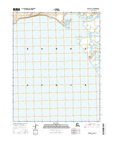
2016 Map of Selawik C-3 SW
USGS Topo · Published 2016About this map
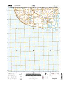
Selawik Lake dominates the southern portion of this landscape, its broad waters meeting the intricate shoreline of the Northwest Arctic Borough. This 2016 survey captures a remote subarctic environment where the Selawik River flows into the eastern reach of the lake, creating a complex delta system of shifting channels and marshy terrain. The prominent Shoniktok Point serves as a distinct landmark along the northern shore, marking the transition between the open lake and the river's mouth. Smaller waterways, including Apatotilik Creek, drain the tundra into the northern basin, illustrating the hydrology of this seasonally dynamic region. The lack of built infrastructure or settlements highlights the isolation of this corner of the Arctic, defined instead by the rhythmic intersection of water and land.
Find a feature on this map
7 named features on this map. Tap any name to fly to it.
Don’t see what you’re looking for? This feature index may not catch every label — zoom into the map to look around manually.
Map Details
Editions of this 2016 Selawik C-3 SW Map
This is the sole edition of this map. No revisions or reprints were ever made.
Other maps of this area

1951 · Selawik
USGS Topo · 1:250,000

1955 · Selawik B-3
USGS Topo · 1:63,360

1955 · Selawik C-3
USGS Topo · 1:63,360

1955 · Selawik B-4
USGS Topo · 1:63,360

1955 · Selawik C-4
USGS Topo · 1:63,360

1957 · Selawik
USGS Topo · 1:250,000
2016 · Selawik C-3 NW
USGS Topo · 1:25,000
2016 · Selawik C-3 SE
USGS Topo · 1:25,000
2016 · Selawik C-3 NE
USGS Topo · 1:25,000
2016 · Selawik C-4 SE
USGS Topo · 1:25,000