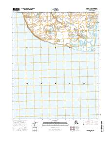
2016 Map of Selawik C-4 SE
USGS Topo · Published 2016About this map
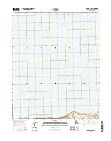
Selawik Lake dominates the southern half of this coastal landscape in the Northwest Arctic Borough. The terrain is characterized by a low-lying alluvial plain where the Singauruk River winds through a complex of small tundra ponds and wetlands before reaching its terminus. Along the northern shoreline of the lake, Singauruk Point stands as a distinct geographical marker, while Napatolik Cr enters from the northeast. The map provides a detailed view of the Public Land Survey System grid, specifically within t14n r10w and t14n r9w, illustrating the remote and largely uninhabited character of this Arctic shoreline during the early 21st century. The hydrological patterns here show a land defined by seasonal water movement and shifting coastal boundaries.
Find a feature on this map
36 named features on this map. Tap any name to fly to it.
Don’t see what you’re looking for? This feature index may not catch every label — zoom into the map to look around manually.
Map Details
Editions of this 2016 Selawik C-4 SE Map
This is the sole edition of this map. No revisions or reprints were ever made.
Other maps of this area

1951 · Selawik
USGS Topo · 1:250,000

1955 · Selawik B-3
USGS Topo · 1:63,360

1955 · Selawik C-3
USGS Topo · 1:63,360

1955 · Selawik B-4
USGS Topo · 1:63,360

1955 · Selawik C-4
USGS Topo · 1:63,360

1957 · Selawik
USGS Topo · 1:250,000
2016 · Selawik C-3 NW
USGS Topo · 1:25,000
2016 · Selawik B-4 NW
USGS Topo · 1:25,000
2016 · Selawik C-3 SW
USGS Topo · 1:25,000
2016 · Selawik B-3 NW
USGS Topo · 1:25,000